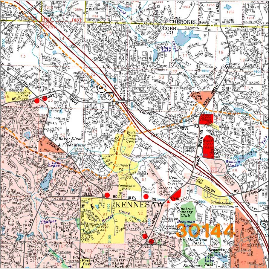
Aero Atlas® Georgia Wall Maps
All wall maps are made-to-order (not mass produced) to ensure that your map is printed to your specifications and includes the most recent map data. Because we only map Georgia, we update our database continually and are able to provide the most up-to-date maps on the market.
Wall maps can be customized to accommodate the exact area, size or special requests needed. Please see "Customize My Map" below for a full explanation. We have (2) levels of map data: ARTERIAL and DETAILED. Each wall map type is marked accordingly in the product box and defined below.
Customize My Map
We can customize both our Arterial and Detailed Wall Maps to accommodate a specific map area and/or size, plot your data, overlay custom shading, coloring or drawing, you-name-it. An image of our coverage area can be found here.
Please choose a map type that most closely represents your desired map from our product boxes below, and check any options that apply. Then choose the “Customize My Map” button and fill in any special instructions or questions. This info will be emailed to us, and we will respond within one (1) business day.
Arterial Map Definition
ARTERIAL wall maps display limited road detail: interstates, highways, and state roads only, as well as, county names, cities, major parks and water, and zip code numbers and boundaries (if needed). Arterial maps are available for the entire State of Georgia or any portion thereof. An image of our coverage area can be found here.
Detailed Map Definition
DETAILED wall maps display all road detail including subdivision roads and private roads, as well as, cities, county boundaries, zip codes, block numbers, schools, shopping centers, industrial parks, hospitals, cemeteries, fire stations, libraries, park and rec. centers, golf courses, water etc... Detailed maps are available for most of North Georgia. An image of our coverage area can be found here.
9 Types of Aero Atlas® Georgia Wall Maps Available Below
Georgia Zip Code Wall Maps - Arterial
Maps display up-to-date ARTERIAL map data: cities, interstates, highways, state roads, county names and boundaries, major parks and water. Maps ALSO display zip code numbers and zip code boundaries in red. Three (3) maps are available: Atlanta Metro, North Georgia, State of Georgia or...Your Custom Area.
Metro Atlanta Zip Code Wall Map 2025
North- All of Cherokee County,
South- All of Spalding County,
East- All of Gwinnett County,
West- All of Douglas County.
Map includes a numerical zip code index in the margin of the map.
Georgia Highway and City Wall Maps - Arterial
Maps display up-to-date ARTERIAL map data: cities, interstates, highways, state roads, county names and boundaries, major parks and water. Maps do NOT display zip code info. Three (3) maps are available: Atlanta Metro, North Georgia, State of Georgia or...Your Custom Area.
North Georgia Detailed Wall Maps
Detailed wall maps are available for Metro Atlanta and most of North Georgia. Map details include: all streets (including subdivision roads and private roads), parks and recreation centers, water, schools, shopping centers, industrial parks, fire stations, hospitals, cemeteries, libraries, zip codes, etc. Our database is updated several times per year ensuring that your wall map will be accurate and up-to-date at the time of order.
